Trip overview
Activity: hiking
Difficulty: difficult to very difficult
Duration: 2 hours in one way
Height difference: 624 meters
Location: https://maps.app.goo.gl/9nEg23x3ZTcxFyiE8
Parking place: https://maps.app.goo.gl/y9CLvNfZkVJEEEyo8

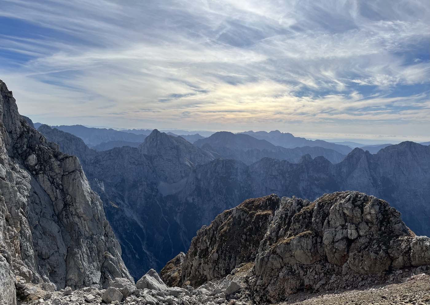
Mangart – The Majestic Summit of the Julian Alps
Mangart, one of Slovenia’s highest peaks, is a breathtaking mountain that attracts a large number of visitors during the summer months. Its accessibility is greatly enhanced by a road that ascends to over 2,000 meters in elevation, bringing visitors closer to the summit and offering panoramic views of the surrounding landscape. The peak itself, crowned by a cross and an inscription box, is expansive, providing sweeping vistas in all directions. One of the most striking views is of the nearby Jalovec, just a few meters lower, as well as the majestic Italian Julian Alps.
Access
The road leading to Mangart Saddle (Slovene: Mangartsko sedlo) is the highest paved road in Slovenia, reaching an impressive 2,072 meters (6,798 feet). The Mangart Pass Lodge is conveniently located at the western foot of the mountain, serving as a starting point for those eager to ascend to the summit.
Path Description
The hike to the top of Mangart from Mangart Saddle takes approximately 2 hours one way. There are two main routes to the summit: the Slovenian route and the Italian route. Both paths are challenging, but the Slovenian route is particularly difficult, as it follows a Via Ferrata—an exposed and technical climb. The Italian route, while challenging in some areas, is generally less exposed.
Starting from the parking area, the first section of the trail leads you to the Mangart Saddle. From here, the path veers right, heading east along a scenic grassy ridge. The terrain is relatively gentle for the first few minutes before the path begins to steepen. On the south side, the trail bypasses the nearby Travnik (2,200 meters), offering stunning views as you ascend. After about 30 minutes of hiking, the trail splits into two distinct routes. To the left lies the Italian path, while the right leads to the Slovenian path.
If you choose the Slovenian path, you’ll descend gently through scree fields before reaching the beginning of the climbing section. Alternatively, the Italian route takes you swiftly onto the Italian side of Mangart, where the path ascends moderately at first. Within minutes, the climb becomes steeper and more technical, with smooth rocky plates and fixed safety equipment, including steel cables, to assist with the ascent.
As you ascend higher, the path veers left, crossing a steep scree slope below the towering walls of Mangart. In early summer, you may still encounter patches of snow along this section. The trail continues to the right and leads to a crossing on the eastern side of the mountain. At this junction, you’ll rejoin the Slovenian side and head right toward the Mangart summit. The path then circles the peak, heading uphill through another gully before the final steep ascent to the top. The last section of the climb is exposed, with a risk of falling stones, but only a few more minutes of climbing bring you to the summit, where the views become increasingly spectacular.
From Mangartsko Sedlo to the crossing, the hike takes about 30 minutes. From the crossing to the summit of Mangart, expect another 1 hour and 30 minutes of challenging, yet rewarding, ascent.
Link for detailed tour: https://www.hike.uno/mountain/mangart/1/4